Are you considering doing the Camino Francés? This route overview for the popular Camino Francés will give you some information on where it starts (and ends), distances, key towns, when to go and some tips on how to get there.
About the Camino Francés
The Camino Francés (French route) is far and away the best-known and most traveled of the many routes to Santiago de Compostela. Three of the main routes through France feed into the Camino Francés through the Pyrenees and a number of the routes in Spain join the Francés at various points along its length.
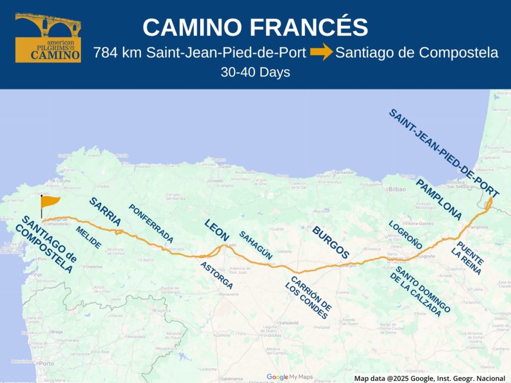
The route starts in Saint-Jean-Pied-de-Port (St. Jean), France, and continues approximately 790 kilometers (490 miles) to Santiago de Compostela The Camino Francés travels through the cities of Pamplona, Puente de la Reina, Logroño, Burgos, León, Astorga, Ponferrada and Sarria to Santiago.
The Camino Francés is hands down the most traveled of all the routes. This could be a positive or a negative depending on the time of year and your desire to be with other pilgrims. April/May and August/September are popular times to be on the Francés. You’ll also find it especially busy the last 100 kilometers from Sarria.
Interesting Things to See on the Camino Francés
All of the routes of the Camino de Santiago are UNESCO-designated. So simply walking along the Way steeps you in history.
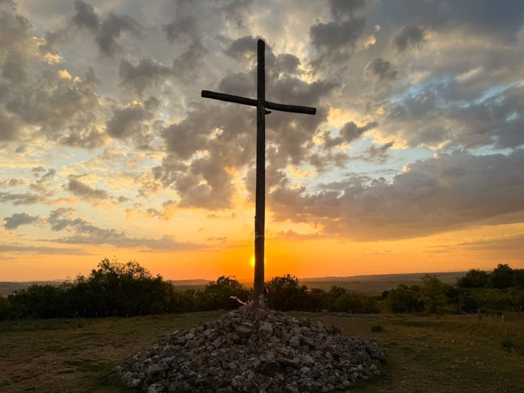
Here are just a few highlights: chasing down Hemmingway in Pamplona, Puente la Reina boasts a lovely medieval bridge, Santo Domingo de la Calzada has miraculous chickens, Burgos has an ornate UNESCO-protected cathedral, León’s gothic cathedral has striking stained glass, Astorga has a Gaudí-designed palace, the Cruz de Ferro is an ancient Christian/pagan cross, and Ponferrada has a Knights Templar castle.
Popular Starting Points on the Camino Francés
The Camino Francés is a long route and not everyone has the time or interest in the entire trip from St. Jean. According to the Pilgrim’s Office in Santiago, the following are the five most popular starting points for the Francés.
- Sarria: 116 kilometers, 5-6 days
- St. Jean: 788 kilometers, 30-40 days
- León: 318 kilometers, 13-16 days
- O’Cebreiro: 163 kilometers, 6-8 days
- Ponferrada: 214 kilometers, 9-11 days
You can start anywhere, and Burgos and Pamplona can also be good starting points because they have ample transportation infrastructure.
How to Get Onto the Camino Francés
Whichever routing you take, it’s a feat to get to the Camino Francés from North America. The most popular international gateways for the Francés are Paris, Madrid, Barcelona or Porto.
Regardless of your European arrival airport, plan to spend the better part of one day with multiple transfers to get to your starting point.
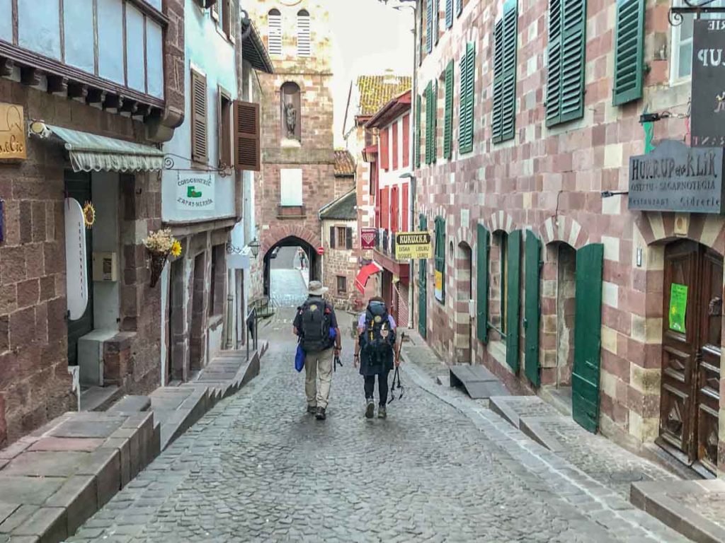
How to Get to Saint-Jean-Pied-de-Port, France
This will vary depending upon your arrival airport and you’ll have multiple ground transportation options. Read our article on how to get to St. Jean to figure out the best option for you.
How to Get to Sarria
- From Madrid airport: Fly to Santiago de Compostela, bus to Sarria.
- From Madrid downtown: High-speed train from Chamartín station to Ourense, then train or bus to Sarria.
- From Barcelona: Fly to Santiago de Compostela, bus to Sarria.
- From Porto: Bus to Santiago de Compostela, then bus to Sarria.
SCNF is the train booking service for France, Renfe is the train booking service for Spain. ALSA, Monbus and Flixbus are the primary long-distance bus services in Spain. And you can use Rome2Rio to help figure out some of the on-the-ground logistics.
How to Get to León
- From Madrid airport or downtown: Train from Chamartín station to León.
- From Barcelona: Fly to Leon.
Similar advice also works for O’Cebreiro and Ponferrada.
Camino Francés Waymarking
The route is extremely well marked with painted yellow arrows, trail bollards, plaques and signposts, the latter usually with stylized scallop shell symbols. As long as you are paying attention, it’s hard to get profoundly lost on any of the major Camino routes.
If you want backup, we recommend downloading a Camino app. There are several with excellent maps that you can download for offline use.
Terrain on the Camino Francés
The terrain is quite varied beginning with the ascent/descent through the Pyrenees, then passing through the rich vineyards of La Rioja, the vast flat(ish) Meseta between Burgos and León, then into the Montes de León before crossing the high pass of O Cebreiro into the province of Galicia.
Expect farmlands, woods, mountain passes, small villages and large cities. Underfoot you’ll find a mix of dirt trails, gravel farm roads, sidewalks and paved roads.
When to Do the Camino Francés
The route can be traversed at all times of the year as there are at least minimal services available year-round. There are two routes across the Pyrenees to Roncesvalles: The Napoleon (which is a mountain pass and Valcarlos (somewhat lower). The Napoleon route is closed from November 1st to March 31st. You’re likely to see snow in the winter months and early spring in the Pyrenees, the Montes de Oca (east of Burgos), the Montes de León, and in Galicia.
You will find full services from April into early November.
Accommodation and Services
Among all the routes, the Camino Francés has without question the most highly-developed infrastructure with plentiful sleeping accommodations of all types, and frequent towns with cafes and other services. You’ll rarely need to go more than 10 kilometers without finding services. Some of the regions also have plentiful public water fountains.
Our Camino albergue and lodging guide will give you information on what types of lodgings are available, general pricing and advice on how to book.
Camino Francés Guidebooks & Apps
The map image at the top of this page comes from this Google map which includes GPX tracks for the primary routing. This map is a useful planning tool, but it’s not meant to be your key resource. For more guidance, we recommend one of the resources below, or load in your own GPX tracks, available from the Spanish Camino Federation.
There are numerous guidebooks and apps for the Camino Francés which range from practical planning guides to personal accounts. Check out our guidebook and apps page for an exhaustive list.
Preparing for the Camino Francés (pdf) by longtime Camino luminary Johnnie Walker. Download this special edition created especially for our American Pilgrims members and friends.
More Camino Resources
Request your pilgrim credential from us in advance of your Camino.
Be sure to check out our FAQs on planning your Camino and what to expect while on the trail. Or explore other Camino routes.
If you have more questions, be sure to join a local American Pilgrims chapter or join us in our Facebook group.