About the Via Podiensis
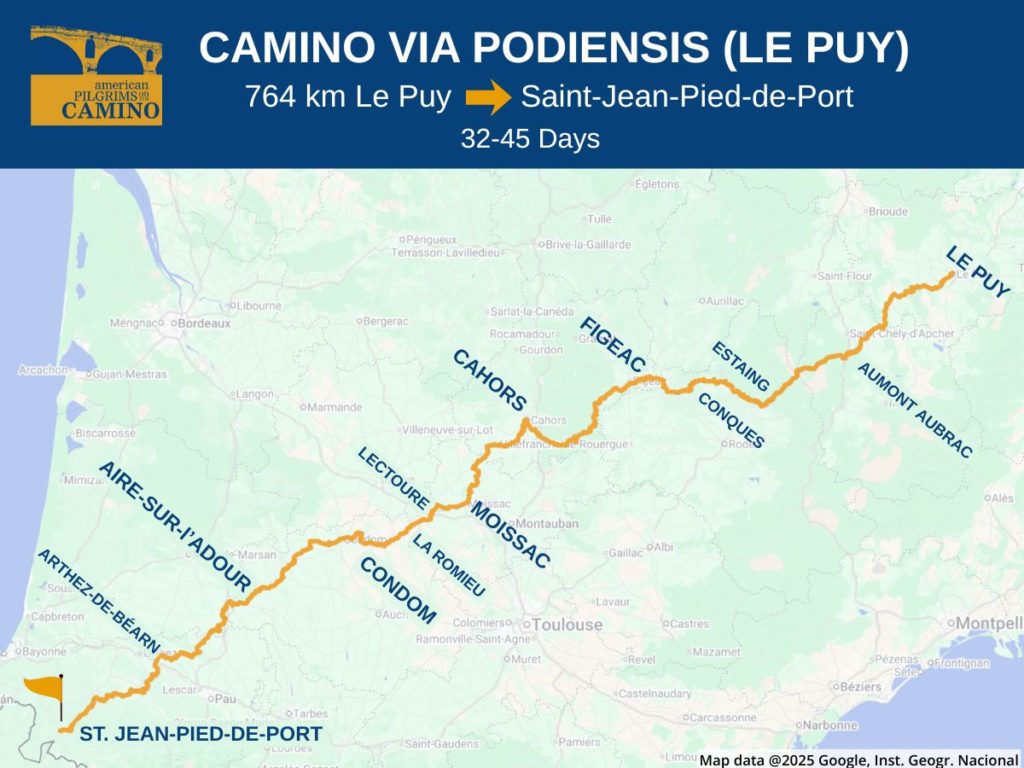
The Via Podiensis is one of the most popular of the official Camino de Santiago routes in France. It runs 764 kilometers southwest from Le Puy-en-Velay, merging with the Camino Francés in Saint-Jean-Pied-de-Port (St. Jean). It’s one of Europe’s official “GR” long-distance trails and is connected to other trails originating in Switzerland, Germany and Benelux.
You’ll find this trail referred to by various names– the Via Podienses, the Le Puy route and the GR65.
It’s believed that around the year 951, Godescalc, the Bishop of Le Puy-en-Velay, set out to visit the tomb of Saint James, taking a large retinue with him. His exact route isn’t known, but there is evidence of many subsequent pilgrims visiting the shrine to the Virgin Mary at the Le Puy Notre-Dame Cathedral.
The trail fell out of use over the centuries but was reinvigorated in the early 1970s with new waymarkings. It received an official designation as the GR65 long-distance route and recognition as a “Chemin de Saint-Jacques” (or official Camino route).
Even though the Via Podiensis is an official Camino pilgrim route, it’s also a popular trail for all manner of hikers who enjoy trekking in France.
Interesting Things to See and Do
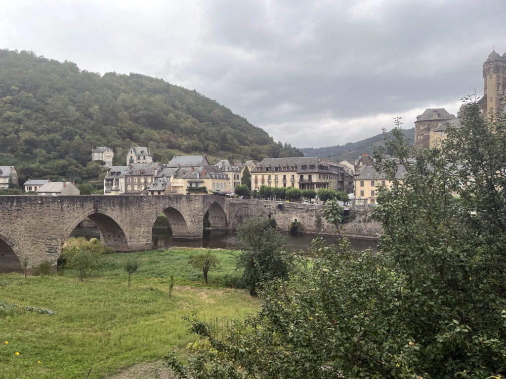
The Le Puy Notre-Dame Cathedral is a major site on this route, featuring Carolingian and Romanesque architecture, a Black Madonna, and a 7 am pilgrim Mass that offers a stunning surprise. There’s no shortage of UNESCO heritage sites on the Via Podiensis including: old bridges in Espalion, Estaing, and Conques, the Saint-Pierre Abbey cloister in Moissac, the road from Lectoure to Condom, and the Saint-Etienne cathedral and ValentrÍe bridge in Cahors.
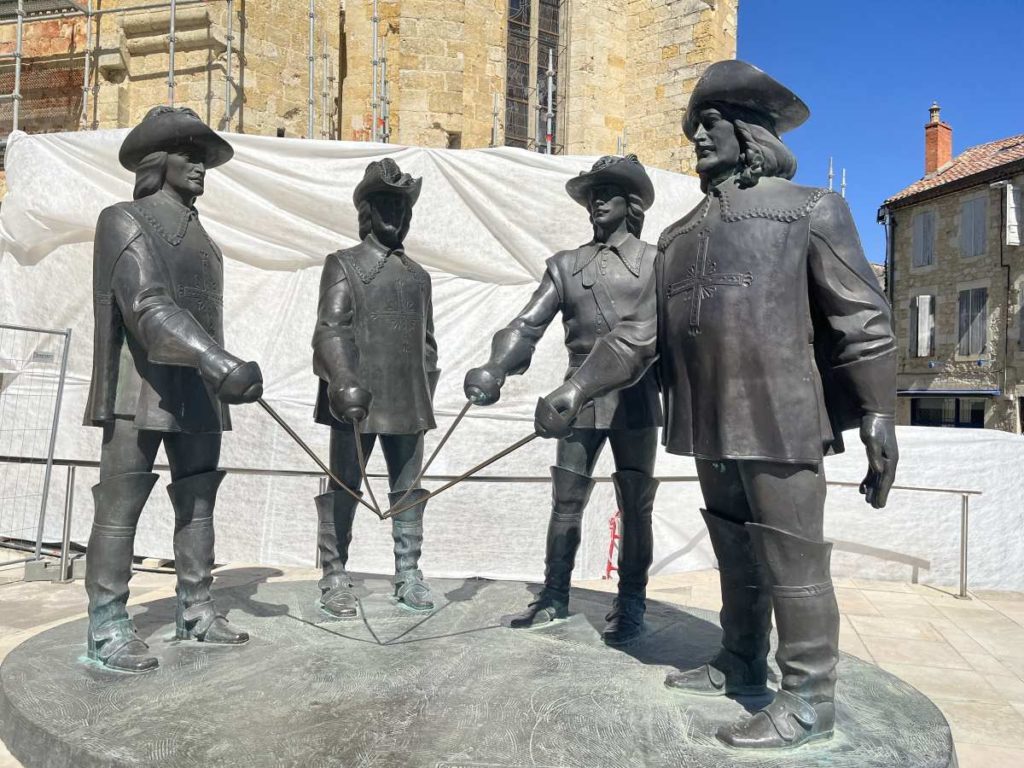
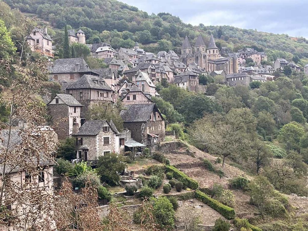
Many of the small villages along the route have received official recognition as “Les Plus Beaux Villages” (pretty villages). These include Conques, Estaing, Navarrenx, and St. Jean. And there are many other villages along the Way that are also quite “beaux”. And in the final third of the route, you’ll find cultural touchstones for Three Musketeers lore.
As for landscape, the route is bookended by the mountainous regions of the volcanic Massif Central and the Pyrenees. The route also transits the L’Aubrac and Causses du Quercy national parks.
Popular Starting Points
Le Puy is by far the most popular start point for this route. The most popular section is the 203 km between Le Puy and Conques. If you want to section hike this route, other major towns are Figeac, Cahors, Moissac, Lectoure, and Aire-sur-l’Adour.
There are only a handful of large cities, and the public transportation infrastructure is such that you’ll likely have to take a combination of buses and trains to get to those start points.
Routing Alternatives
There are three variants that go from Figeac to Cahors. The Lot Valley route is considered the primary route and it follows the river valley. The Célé variant is known for its pretty villages and natural beauty. The third variant tacks further north to Rocamadour – a pilgrimage destination in its own right – and features caves and buildings built right into the cliff face.
How to Get to Le Puy
However you get to Europe, plan to spend most of a day and multiple transfers to get to your starting point.
Lyon, France is the closest major city to Le Puy. It offers a sizeable airport and many train connections. Most major European cities have flights to Lyon, so you should be able to get reasonable connections from North America. You can also fly into Paris and catch a fast TGV train from the Paris Gare de Lyon station.
From Lyon, you can take the train, a bus, or a combination of both to Le Puy.
SCNF is the national train booking service for France. Flixbus offers bus service to Le Puy.
Along the route, there are local buses and there are also two hiker-specific services. The Compostelle bus runs between Le Puy and Conque and the La Malle Postale runs luggage portaging but will also shuttle hikers between Aire-sur-l’Adour and Le Puy.
Waymarking
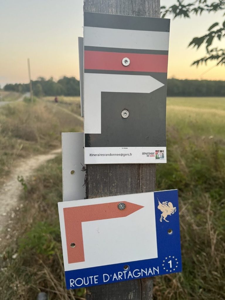
The Podiensis is well marked with the typical red and white GR trail blazes. They’ll be painted onto all manner of surfaces, such as fence posts, trees and traffic signage. There will also be occasional directional signs in yellow, and also blue and yellow Camino shell markers.
That said, it’s still possible to get lost, especially in less well-marked towns. Downloading an app or GPX tracks would be wise.
Terrain
The French hiking federation considers the GR65 the most beautiful hiking trail in France. As an official GR route, they’ve taken pains to try to keep the trail off of major roads.
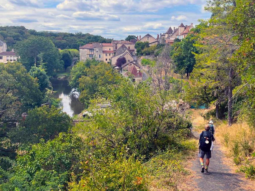
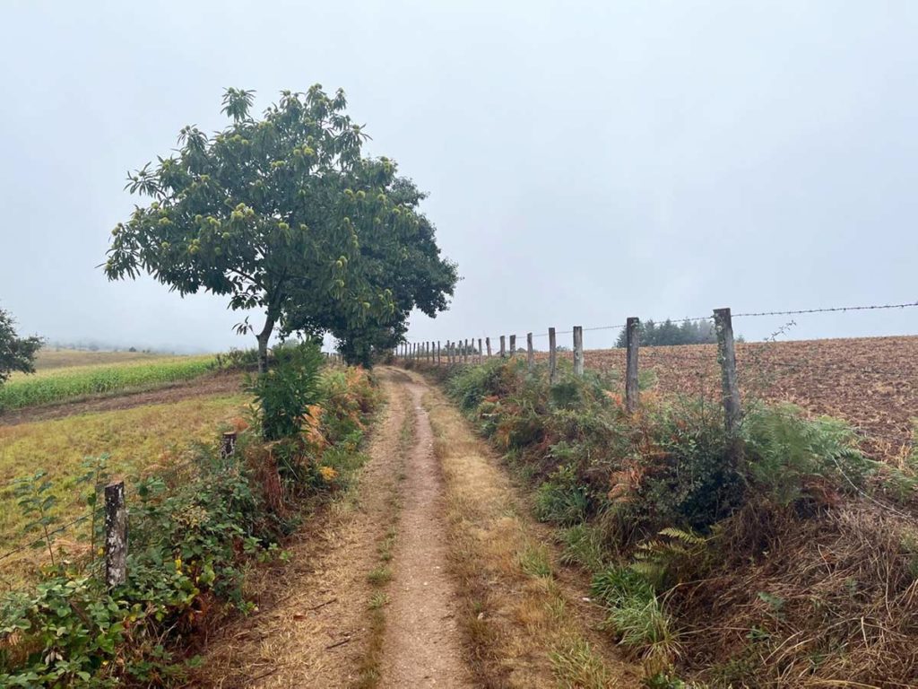
The first 200 km transits the volcanic Massif with a lot of up and down on rocky, dirt trails. After that, the terrain stretches out into more rolling hills, corn and sunflower fields, with more gravel surfacing. You’ll re-enter the mountains a few days out from St. Jean, with moderate inclinations through the Pyrenees.
When to Go
The most popular months are May through September. May is somewhat wetter than the rest of the summer but also busy because of the French holidays. June offers milder temperatures. August is a busy vacation time in France, and some local services may be closed.
September can be a sweet spot with a lower chance of rain, mild temperatures, and lower competition for lodgings.
Accommodation & Services
Parts of this route are among the least inhabited in France. Expect uneven distances between towns, which may force you into a longer +30 km day or a shorter -20 km day. This also means there are many stages with no services, so you’ll need to carry plenty of food and water for the day. All public cemeteries are plumbed with potable water.
For lodging, expect primarily gîtes but also small hotels in the larger towns. Gîtes are small hostels or homestays, usually featuring group rooms with single or bunk beds. Many offer breakfast and/or dinner.
Expect it to be more crowded between Le Puy and Figeac, so consider booking in advance for that section. Further down the trail, it becomes more possible to go day by day. That said, many of the gites come demi-pension, which includes dinner. If you want the dinner (and you’ll want the dinner), you’ll need to reserve at least a day ahead. The guidebooks and apps can help with that, but so can the host at your previous night’s lodging. In the larger towns, the local tourism bureau can also be of great service.
Food along the Le Puy is very fresh and regional. The dinners offered by the gites are hearty, multi-course home-cooked meals.
There are a lot of French-speaking folks who enjoy this trail, and you can’t count on your hosts to speak English. You would be well served to learn some basic French and develop competency with translation apps.
Guidebooks and Maps
The map image at the top of this page comes from this Google Map and it includes the primary GPX tracks. But it’s not designed to be your key resource. For more guidance, we recommend one of the resources below, or load in your own GPX tracks, available from the Spanish Federation.
Some of the major websites and apps offer a version for the via Podensis. You can find them listed on our apps page.
The two major guides for this route are the Cicerone guide, and the Miam Miam Dodo guide. The latter is in French, but it’s very thorough, and they use a lot of symbols to indicate services, making it easy for an English speaker to use.
Thanks to Thom Ryng for helping us compile this overview. Thom is the author of Practical Pilgrimage: Useful Rules for Walking the Camino de Santiago. He’s also a trained Hospitalero and member of the American Pilgrims communications team. He did the Via Podiensis in 2023.
Check out some of his musings about the Podiensis here.
More Camino Planning Resources
Request your pilgrim credential from us in advance of your Camino.
Be sure to check out our FAQs on planning your Camino and what to expect while on the trail. Or explore other Camino routes.
If you have more questions, be sure to join a local American Pilgrims chapter or join us in our Facebook group.