Are you considering the Camino Vía de la Plata? This overview for the route will give you information on where it starts (and ends), routing options, distances, key towns, when to go and some tips on how to get there.
About the Vía de la Plata
The Vía de la Plata (or Silver Route) is so named because it was part of a series of Roman roads which connected southwest Spain to the north, linking Mérida to Astorga– both of which were once important Roman cities. Some scholars believe that the Roman road network once transported precious metals from northern Asturias down to the southern port in Cádiz. You can even still see some markers where the original Roman roads once were.
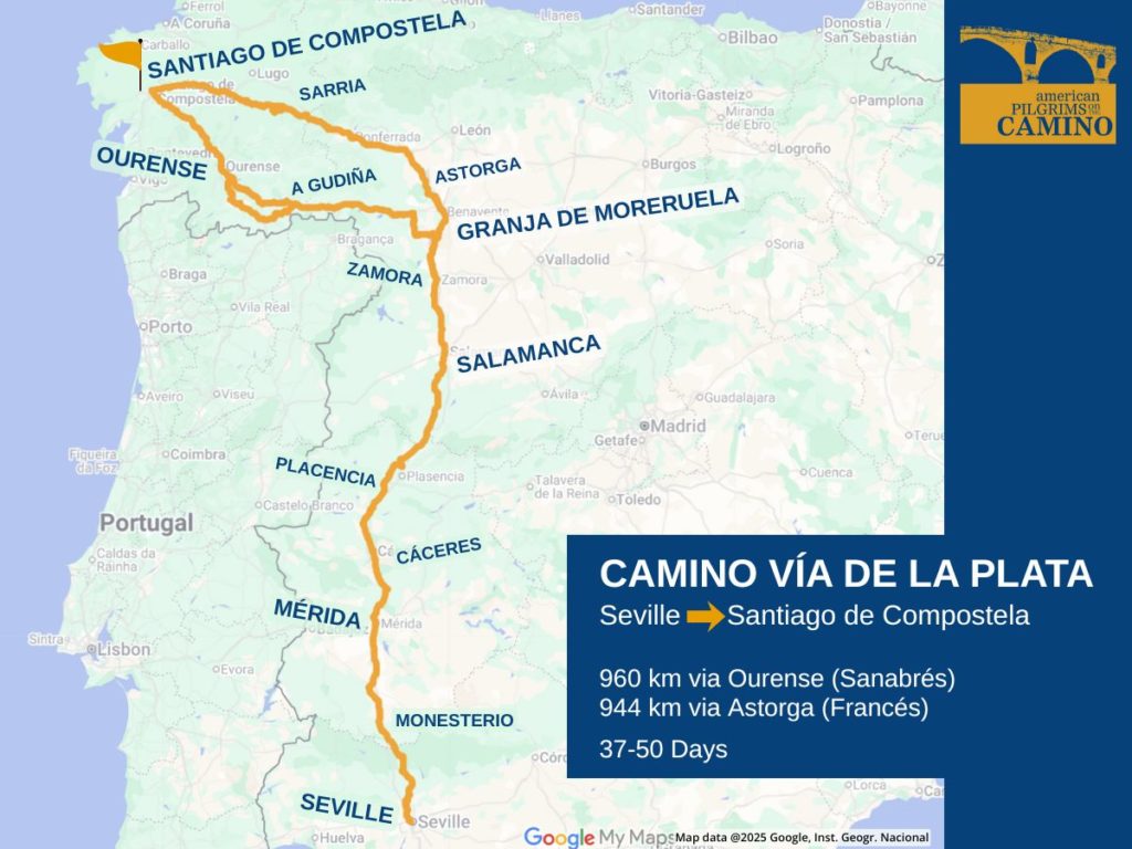
This 960-kilometer route ranges through a varied terrain covering the Spanish regions of Andalucía, Extremadura, Castile y León, and Galicia.
The route splits just after Zamora, offering the choice of taking the Camino Sanabrés via Ourense or connecting with the Camino Francés in Astorga.
Only about 1.6% of pilgrims who register at the Pilgrim office in Santiago have chosen to take the Vía de la Plata. It’s an excellent route for the experienced pilgrim who’s up for managing their own logistics and who can handle longer distances with plenty of solitude.
Interesting Things to See and Do
Seville is a great city featuring a rabbit warren of cafes and tiled Moorish architecture. Salamanca hosts one of the oldest universities in Europe and has a beautiful Plaza Mayor. Mérida is a great stop for Roman ruins, and there are Romanesque churches in Zamora. Depending upon your route choice, you can find GaudÍ in Astorga or hot springs in Ourense.
Popular Starting Points
Seville is the traditional starting point for the Vía de la Plata. Although (if you’re keen to tackle it in sections) some pilgrims start in Salamanca (491 total km) or Zamora (422 total km), both of which offer good bus and train connections.
And some pilgrims choose to start in Ourense. The 126 km routing into Santiago de Compostela offers that 100 km sweet spot for those seeking a shorter route, a quieter vibe and a Compostela.
Routing Alternatives
The route splits at Granja de Moreruela, which is a two-day walk north of Zamora.
- 960 total km via Ourense (Camino Sanabrés)
- 944 total km via Astorga (Camino Francés)
There’s also a major variant just before Ourense (noted in the map above). The guides and apps will also show various shorter variants along the way, often for the purpose of guiding you into a town for services.
How to Get to the Vía de la Plata
Regardless of your European arrival airport, plan to spend the better part of one day with multiple transfers to get to your starting point. Your international gateways will likely be Madrid, Barcelona, Lisbon or Porto. Seville has an airport (SVQ) that is served by all of those cities.
There is also regular train service from Madrid to Seville, Zaragoza and Salamanca. Renfe is the train service for Spain.
Long-distance buses are served by Monbus, Avanza Groupo or Flixbus, with the primary carrier changing by region.
Waymarking
The route is well-marked with painted yellow arrows, trail bollards with shell symbols, plaques and signposts, the latter usually with stylized scallop shell symbols. However, you’ll need to pay careful attention. The type of signage varies throughout the different regions. And you’re unlikely to have fellow pilgrims nearby to steer you away from taking a wrong turn.
Terrain
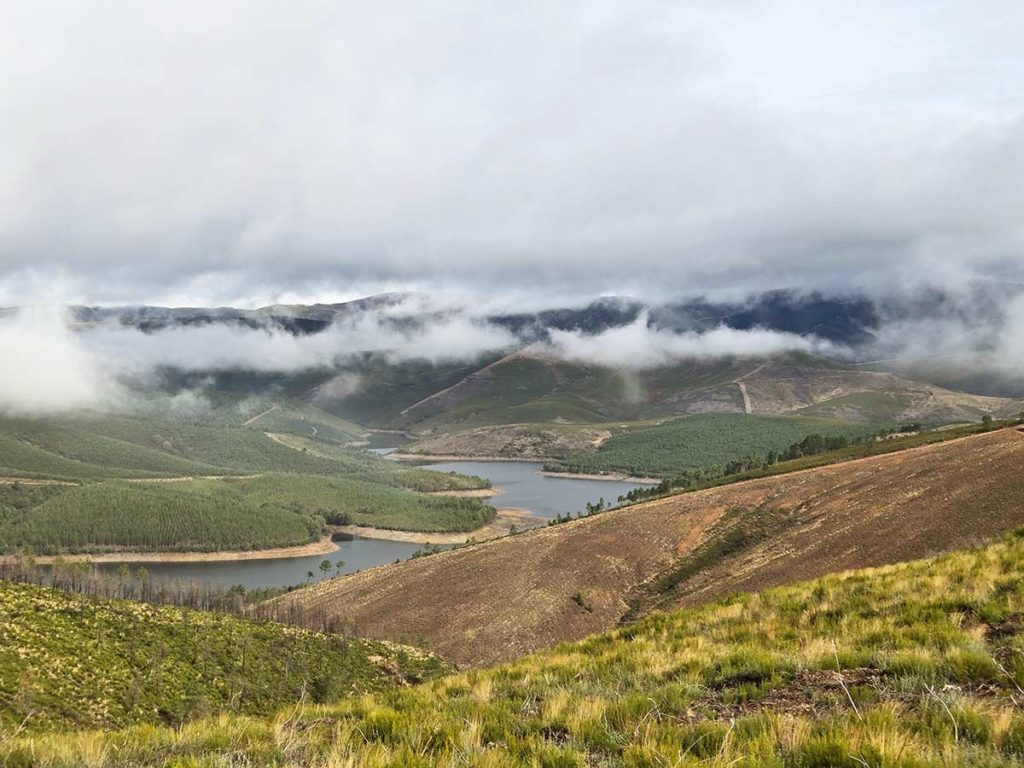
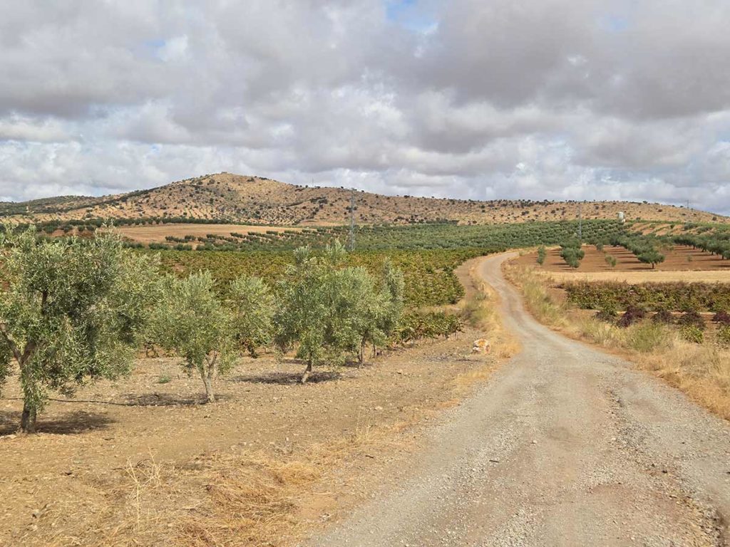
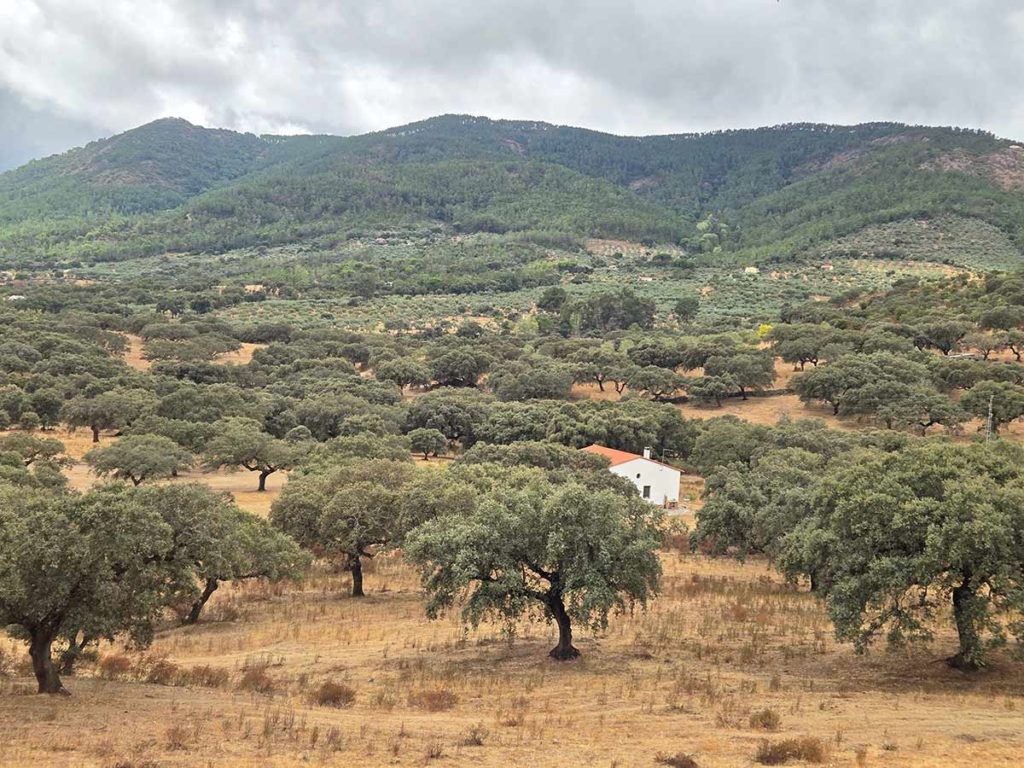
Because the Vía de la Plata transits through so many different regions, you’ll get quite the range of landscapes. Expect rolling fields of grain, olive orchards, dense oak and eucalyptus forests and the unique dehesa. The dehesa is found south of Salamanca, and it consists of open woodlands with ancient holm oaks.
Expect a hilly terrain with a fair amount of surface walking intermixed with dirt paths and farm roads.
When to Go
Given the southerly start point, this is definitely not a Camino to be tackled in the summer months. All of the prevailing wisdom advises against it. Mid-spring is a nice time with average temperatures in Seville and Salamanca in the 60s-70s Fahrenheit. You’ll also get moderate temperatures starting later in September, but expect it to be cool and rainy in Galicia in the fall.
Accommodation & Services
This Camino is characterized by long stages between towns, services, and accommodations. Periodic days of +30 kms are not unheard of. Plan to bring sufficient food and more water than you might think.
This Camino doesn’t have a strong tourism infrastructure, so it helps to have some Spanish fluency, or at least experience using translation apps.
Our Camino albergue and lodging guide will give you information on what types of lodgings are available, general pricing and advice on how to book.
Guidebooks and Maps
The map image at the top of this page comes from this Google Map, and it includes the primary GPX tracks. But it’s not meant to be your key resource. For more guidance, we recommend one of the resources below, or load in your own GPX tracks, available from the Spanish Federation.
Most of the major websites and apps offer a version for the Vía de la Plata. You can find them listed on our apps page.
Guidebooks are less prevalent for this route. But there is a detailed guidebook called Walking Guide to the Vía de la Plata and Camino Sanabrés, by Gerold Kelly.
Thanks to Blaine Rada for helping us develop this overview. He’s a member of American Pilgrims and a trained Hospitalero. He did the Vía de la Plata in 2024.
More Camino Planning Resources
Request your pilgrim credential from us in advance of your Camino.
Be sure to check out our FAQs on planning your Camino and what to expect while on the trail. Or explore other Camino routes.
If you have more questions, be sure to join a local American Pilgrims chapter or join us in our Facebook group.