Are you considering the Camino Inglés? This route overview will give you some information on where it starts (and ends), routing options, distances, key towns, when to go and some tips on how to get there.
About the Camino Inglés
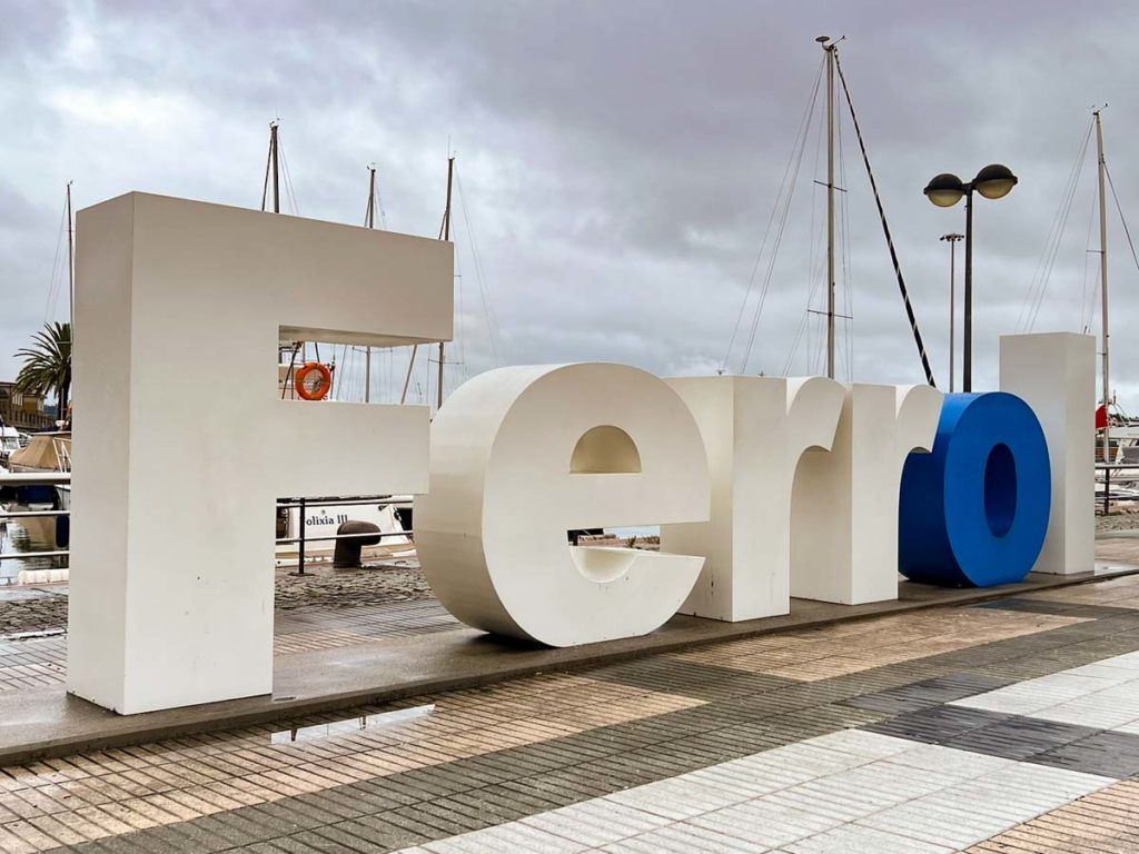
This route earned its name due to the number of pilgrims coming from northwestern Europe, particularly Ireland and the United Kingdom. There is evidence that the Inglés has been in use since the 11th century. Pilgrims would start in their home country, perhaps at Canterbury cathedral in England or Croagh Patrick in County Mayo, Ireland. They would then travel across the sea, landing in either Ferrol or A Coruña in Spain, and then continuing on to Santiago de Compostela.
Some pilgrims are still doing this land-sea-land pilgrimage. And others are choosing the route for the shorter distance and coastal estuary.
Starting Point and Route Alternatives for the Inglés
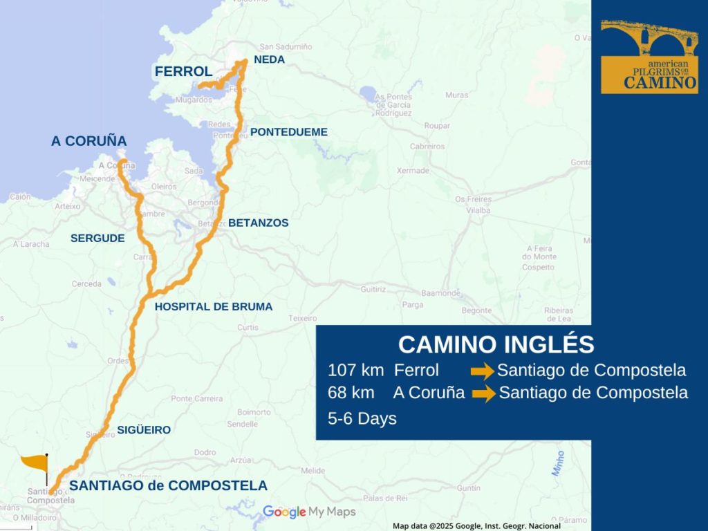
You can begin in either Ferrol or A Coruña. The routes converge at Hospital de Bruma.
The A Coruña route is only 75 kilometers, which is not enough for a Compostela on its own. However, if you start in your home country on a recognized Camino route, the Pilgrim’s Office in Santiago will recognize your effort with a Compostela. Qualifying routes in the US include the Camino de las Américas in St. Augustine, El Camino de San Antonio Missions and The Camino de San Francisco.
The Ferrol route is 117 kilometers and easily qualifies for a Compostela.
Some pilgrims begin in Ferrol, get to Hospital de Bruma, then bus to A Coruña and walk back to Hospital de Bruma. This adds 1-2 days and allows them to experience both routes.
How to Get to the Camino Inglés
There are nonstop flights to A Coruña (LCG) from international gateways in Madrid, Barcelona, and London-Gatwick, and seasonal service from several other European cities. There are even more flights into Santiago (SCQ).
There is frequent train and bus service from Santiago to both A Coruña and Ferrol, which takes 30-90 minutes.
Renfe is the train booking service for Spain. ALSA, Monbus and Flixbus are the primary long-distance bus services in Spain. And you can use Rome2Rio to help figure out some of the on-the-ground logistics.
Camino Inglés Waymarking
The Camino Inglés is well-marked, and if you pay attention, you aren’t likely to get lost. Like other routes, you’ll find a mix of concrete bollards, painted arrows, embedded shell symbols and wooden trail signs. You’ll even spot some Camino themed street art.
That said, there were some adjustments made to the route and some of the old signage may still be out there. Stay sharp and consider using a Camino App.
Terrain on the Camino Inglés
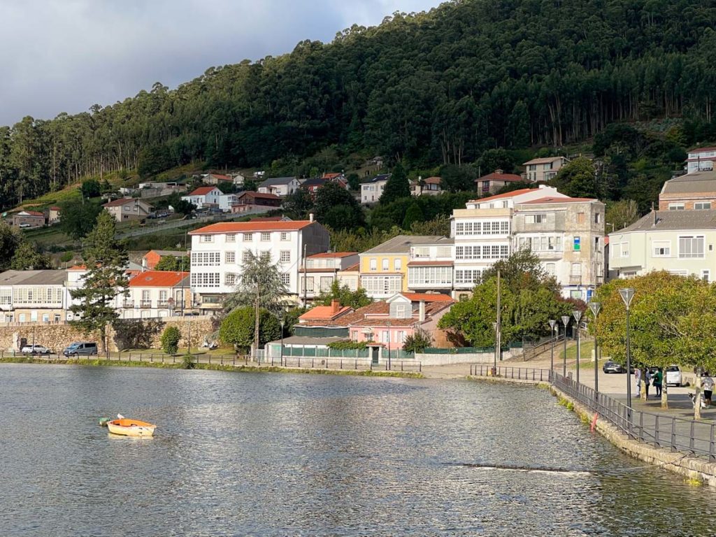
The terrain is a mix of tidal estuary, woodlands and towns. The paths are a mix of dirt and quiet country lanes, with more of the latter (and more hard surface) than the former. This routing offers a fairly hilly terrain, but it’s not mountainous.
When to Do the Inglés
This routing sits squarely in the cool, wet Galician weather patterns. Spring is often wet and windy. Summer is warm and busy. Autumn has pretty stable weather with a less-busy vibe. You can walk this route in the winter, but expect it to be quite wet and some albergues will be closed.
Accommodations
This is not the most popular Camino route, but it is growing. The local businesses and the Galician government have been working to build out more infrastructure to support that growth. Be aware that the trail convergence at Hospital de Bruma means that beds can be tight. You may want to consider booking ahead there.
Most of the larger towns offer albergues. They may have a mix of private and municipal albergues, or just one or the other. There are also a number of small hotels and casas rurales along the way.
Some private lodgings are not right on the trail, but they will often work with you to provide a pick-up and drop-off.
Our Camino albergue and lodging guide will give you information on what types of lodgings are available, general pricing and advice on how to book.
Camino Inglés Guidebooks
The map image at the top of this page comes from this Google map which includes GPX tracks for the two routes. This map is a useful planning tool, but it’s not meant to be your key resource. For more guidance, we recommend one of the resources below, or load in your own GPX tracks, available from the Spanish Camino Federation.
Our guidebook and apps page offers an exhaustive list of guidebooks. You can also get information from the Galician Xunta (government)– their guide includes a list of albergues and notable natural and historical sites.
More Camino Resources
Request your pilgrim credential from us in advance of your Camino.
Be sure to check out our FAQs on planning your Camino and what to expect while on the trail. Or explore other Camino routes.
If you have more questions, be sure to join a local American Pilgrims chapter or join our Facebook group.